beluga

beluga

Thursday, March 29, 2018

a quick update from Lake Powell

The internet is slow here.    Everything is slow and we don't mind it one bit.  No TV either.   We're enjoying the quiet and our Sirius Radio and going to bed when it's dark, and getting up when we feel like it.   

We're never quite sure what time it is and that contributes to the slightly off kilter feeling so we're just going with the flow.   Here at this site (C24) we're in Arizona time, but just one loop down (Where MonaLiza and Steve were) our phones told us something totally different resulting in us arriving an hour early for Happy Hour on Sunday.

our everyday view

We've enjoyed a couple Happy Hours with friends and done a lot of dirt road explorations.    Pictures take a long time to load so I'll just give you a little taste of what we see. 

sacred Navajo Mountain with her little cloud cap


deep grey soil makes the downhill going tough

Enjoying the sun on my face sitting on little chairs built by Mr. David's
Furniture Design  and Stone Building Mobile Crew, Utah Division.

behind  Coxcomb Ridge

perhaps he needs the services of a Hornthodontist?

an unfinished family sculpture?

tiny Juniper bearing fruit in a boulder crack
Grosvenor Arch

Saturday, March 24, 2018

Final post from Hurricane

We're packing up and leaving in the morning.   We'll be back, this area has too much to offer for just a week.


One of the first days this week as we were just wandering around, getting the lay of the land, we turned onto Mesa Road and immediately found ourselves climbing up on a one lane, semi paved road.   


I didn't like it....didn't like it at all because it was only one lane and we were on the outside of the climb.   My side of the Jeep was on the edge and I didn't like it one bit.    I could see the road ahead of me, cut into the side of the mesa, steadily climbing.     I "politely requested" a turn around at the next wide spot and Dave wisely agreed to my suggestion.


When we got home I spent some time on google earth where I found the other end of Mesa Road, called Smith Mesa Road.   A few days ago we headed out to drive the entire top of Smith Mesa and come down that scary road on the inside this time!

enormous Smith Mesa
(see the tiny white cars at it's base?)

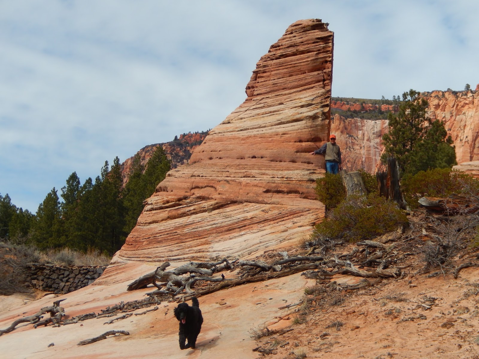
on the top of Smith Mesa

Smith Mesa Road turned off Kolob Terrace Road after most of the climbing had been done on that nice, wide, paved road so we (read - I) could relax and enjoy the views.      It was a long long road on the mostly flat mesa top.     We were high but it almost didn't feel that way.   We drove along on a red dirt road through fields of platinum grasses and pines.    In the distance were more red rock formations and, sometimes, the Pine mountains.


 In places the road was very wet and rutted with water standing in some of the deeper tracks.      With no map, cell coverage and only a rudimentary idea of where we were going we made a few miscalculations.


At one point we made a turn onto what a small sign said was Mesa Road (that's the name of the scary road we were eventually looking for).   Hmmmm.   It didn't look right.    It felt like we were off course, were driving on a tractor path in a cow pasture not the muddy but wide and obviously traveled "road" we had been using.

Hey....get outta our pasture

this doesn't look right......

When the tracks finally petered out to nothing, we realized our mistake and turned around.    Backtracking eventually led us right and we continued along without further detour.

this pretty Meadowlark probably knew we made the wrong turn

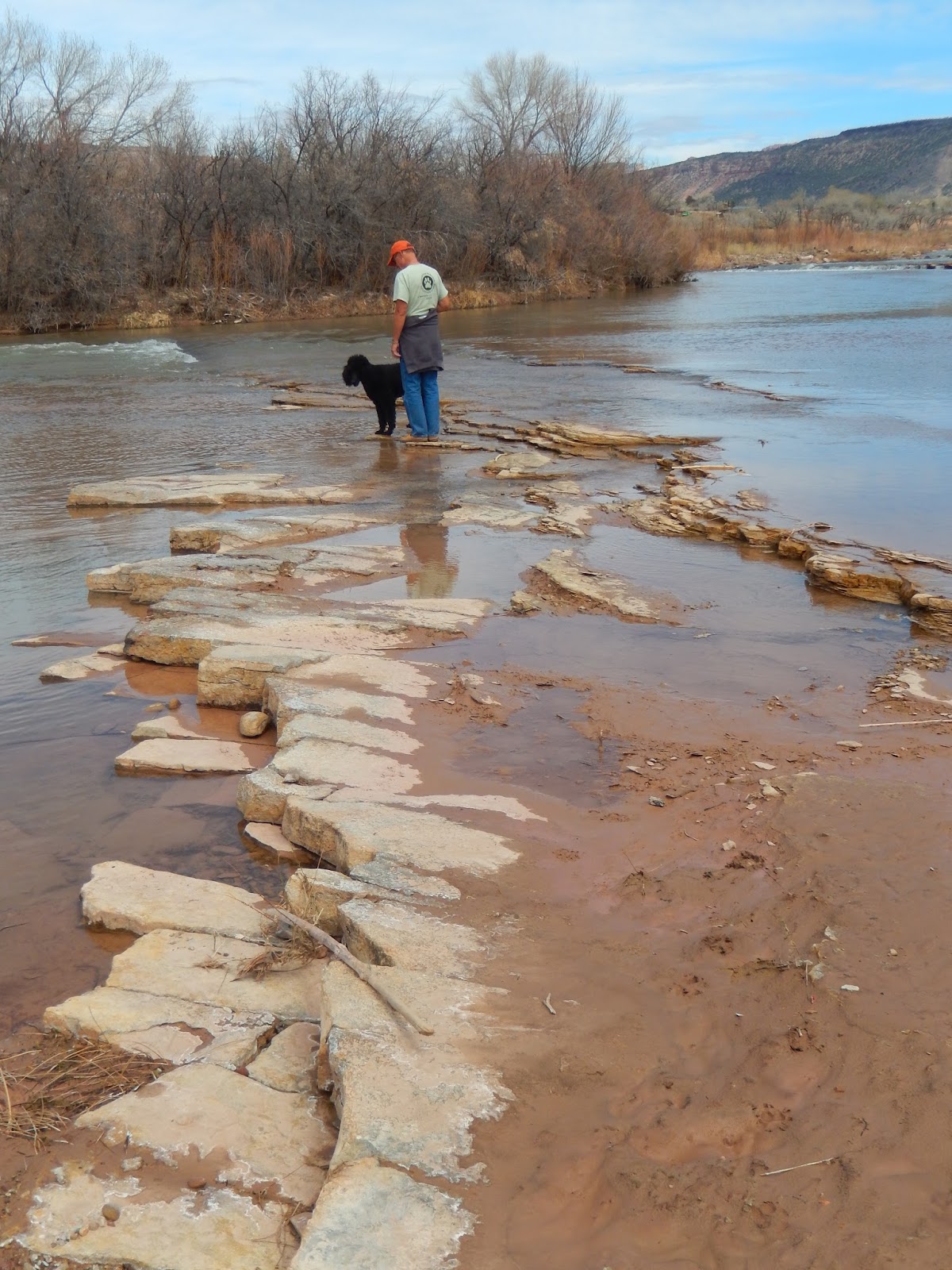
To make an already long story short, we made our descent via Mesa Road, on the inside this time.    The views were beautiful, and we made it to the bottom without incident.


On our last day we drove about 40 north on I-15 to see the Kolob Canyons section of Zion National Park.   As I said before, my knee is being obnoxious so I'm limiting myself to short, flat walks and I heard that we could experience this spectacular part of the park via a 5 mile scenic drive.


There were many spots to pull off and drool over the scenery but there were very few people around to do so.    This seems to be a less visited part of the Park.   It is scheduled to close for repaving in the next week or so - we were glad to be able to see it while we were here. 
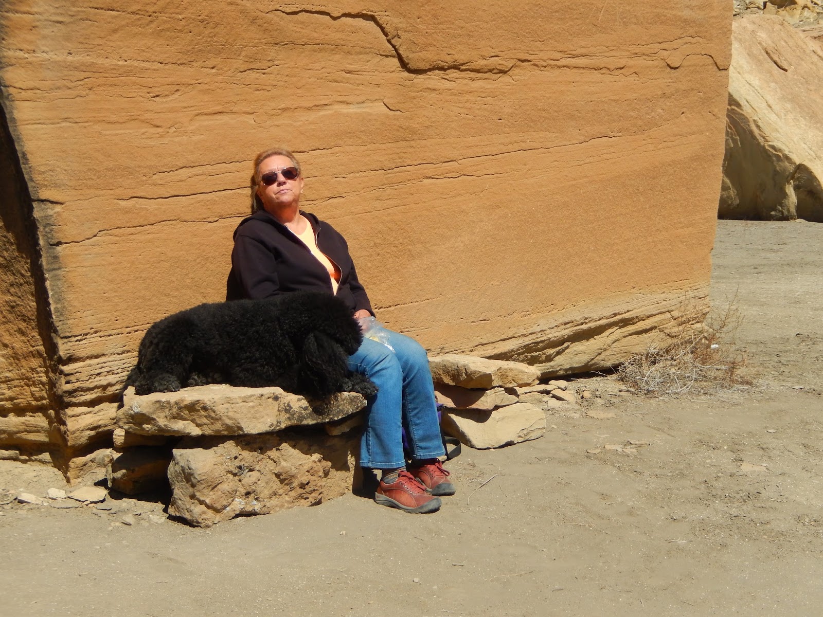


our lunch spot

I hope you're not tired of seeing pictures of rocks and mountains and rivers because tomorrow we move to Lake Powell for more of the same!

One last rock formation for you.    I see it right outside my dining table window.

totally gratuitous picture of Lewis pointing at the Nipple

Molly's Nipple
   

Thursday, March 22, 2018

Thursday

Its near the end of our stay already so today we took time to go to the Visitor Center and the BLM (Bureau of Land Management) headquarters in St. George.

the Tabernacle seems to glow even on a gloomy day


 Our usual pattern is to bumble around an area, seeing things by chance and then, when it's almost time to leave, we get around to picking up maps and other helpful information to help us get the most out of our stay.


It seems to work well for us, we've always done things this way and have come upon some pretty spectacular things in the most unexpected places.

Virgin River at the Virgin Falls park

We wandered around our "home" at first.   Sand Hollow Reservoir isn't a very large body of water, but the neon orange sand running directly down to the blue water, flanked by snow dusted mountains makes for a wonderful spot.


tiny Mr. Bufflehead


One day we turned right out of the State Park's entrance and went where the spirit moved us.


pecan grove at Confluence Park in LaVerkin

We turned off onto a dirt road and followed it until we came to another narrow track leading to a tiny park on the banks of the Virgin River.

the original Sheep Bridge on Sheep Bridge Road below the modern bridge


everyone here is so very polite......


Dave and Lew select the perfect lunch spot


We ate lunch beside the narrow rapids while Lewis explored and waded.  We were the only ones there.

raccoon tracks


We enjoyed the warm sun for a long time before continuing along the road. 

Another dirt road led us to some beautiful views over the small town of LaVerkin and the Virgin River gorge.


Dave overlooks the trails and river far below

a makeshift shrine on the rim of the gorge - we wondered what happened here

Pam and John told us that they ran into snow at about 7000 feet on Kolob Terrace Road so we decided to drive up and let Lewis have a little romp in the white stuff.

The scenery was just beautiful along the drive.

we needed to get down and see these formations up close

We pulled off the road to explore an area with really unusual rock formations.
My knee has been singing to me lately so we found a nice, sandy Elk trail to follow instead of rock crawling.

tracks in the sand


hurry mom, we're already here, hurry, he's waiting, come on!

Lew always finds water

waiting

Back on the road, we passed a small tent community called Under Canvas.    Evidently they are for folks who want a "glamping" experience, complete with private bathroom and woodstove heat, near various National Parks.

spectacular spot to glamp!


The higher we went, the colder it got until we started to see snow along the road's shoulders.


We got out and let Lewis have some fun.  He dug, he ran and he caught snowballs.


Lew is a ball dog.  Rubber, plastic, snow....makes no difference to him


We drove up as far as the reservoir but it was obviously frozen over and the road was getting bad so we turned around and headed back down to warmer elevations and home.